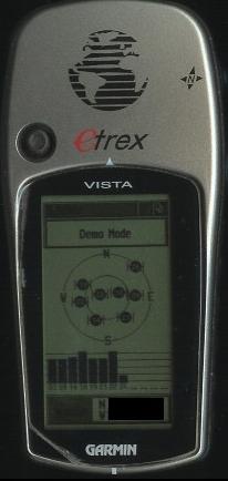
Its in black and white, the color in the 60csx is better definition.
*Garmin Etrex Vista, GPS60CSx with TOPO Canada or US*
This is an over all look at Garmin GPS. Over the last 6 years I've bought and used the Vista & last summer I received a 60CSx for a gift. I have also used some of the Etrex lines, so I have seen some pros and cons from all of them over time.
The Etrex version is very basic and and does not have a lot of detail and the resolution leaves something to be desired. It loses the satellite signal going down into gentle coulee (small valley associated with knolls) or forested regions. We could not use it for some very basic geocaches that we were trying to locate. It kept telling us it was in a different direction and distance every time it received a satellite signal.
With the Vista you will get a lot more, but you do not get color or the ability to expand the with use of a Micro SD. With the new color version you will get longer battery life then B-W technology. Go figure! But it does. You have the ability to pan the screen with a joy stick this will help you when you need to pan the maps or to make a route to select a spot on the map. You can point click or go to by the joy stick. You will only get 24 megabytes of internal memory. If you donÆt have what you need you have to get to a computer or laptop and you may not have this ability to do so or the software also. You need to look at TOPO Canada & USA, G7ToWin, Ozi Explorer, GARtrip, GPS Utility, EasyGPS, or ExpertGPS.
Its in black and white, the color in the 60csx is better definition.
You will have to see what will work for you. Also see what your group has, they may have different models. If so, try to go with what the group is using for ease of co-ordinating.
So if you have the older Etrex line you will need a laptop or computer with you to change data. If you look at the newer Etrex Venture CX, Legend CX, Vista CX you will have the ability to use a Micro SD card. You can get them from 64MB to 4 GB. I would keep it to a maximum of 1GB, as a 4GB will slow the GPS down a lot!! I can put all of Saskatchewan on a 256 Mb Micro SD card and still have 60 Mb leftover. You can get the card from Walmart for $25.00 you can have all of Canada in hi-res for under $150.00. If you got it pre-loaded from Garmin just for one region of Canada you would pay $89.95 for each Region. For all 13 Regions that is $1169.35. Make it yourself :). Micro SD card slot gives you the versatility of adding optional maps on the go.
(All so you can move the map data from the Garmin file, gmapsupp.img, off the Micro SD to a jump drive and by copy and paste then you can keep it with your GPSMap60CSx just transfer and paste back in to the Micro SD in the Garmin file. Make a file with the area name on it then transfer in to that file. So if I'm out and have access to a laptop and a SD card reader I put the map I need to see on my Micro SD.)
What will it get you if you put out a few extra bucks into a newer GPS... if we just look at the Garmin line. There are the Etrex Venture CX, legend CX, Vista CX, GPSMap60CSx and then TOPO mapping software.
How can this work for you:
Garmin Etrex Venture Cx which is the base model starts at $229.99Can
Features:
GPSMAP 60CSx starts at $459.95
I also have TOPO Canada and USA. I've heard the pros and cons of a lot of map software and if you need to start somewhere TOPO USA or Canada is the place to start. It may not have all of the altitudes or creeks but it has a lot, if not too many, for Canada. For my place it shows there are creeks, but it would have to rain for 40 days and 40 night to have any water that would be worth noting.
With TOPO you can get the data you need and be able to place it on your GPS with out much trouble. It is a topographic map, so you will get roads, trails, summit peaks, and many other geographical points. If you need, you can print it out for a hard copy.
Over all, you load it to your laptop or computer, but you will need to have Pentium processor, Win 98 or newer, at least 32 MB of Ram, 350 mb free hard disk space, cd-rom drive, 256-color 24-bit color recommended, mouse, serial port, and usb port to run it.
When you put the 1st CD in you will get to pick the maps you want to have so if you donÆt want eastern USA you donÆt check it.
Garmin Topo Version 2.0
Product Features:
At this link you will get a Tutorial (about 2min): Mapsource Tutorial
As for me, I donÆt need at this time Ontario, Can. I only need to load the region that I want at the time. When Topo opens it, a map will come up and you will see the map at 200 miles. You can zoom in or out. You will see the state lines or provincial lines and in those lines you see a form of grids. Each grid in itself is a map that you can click on and highlight to save to your GPS, by using your mapping tool. The data size can vary and depends on what detail is in the grid.
To send the data to the device, you have 2 icons that look like a GPS. One to receive info from the GPS to computer and one to send info to the GPS from the computer. Both via the cable that comes with the GPS.
You can plan trips with your BOV turn-by-turn. So if you plan to bug out to your cabin, you can make your own route by using Topomaps and preloading the route or you can use your GPS in the bov create a track and save it for use later and then send it back to Topo. Or third, the Topo mapping software will also do this for you from one point to another. You can click at your start point then to your cabin and it will plot a course for you this may not be the best for you or the shortest but it will get you there. You should have multiple ways of getting out to your bug out location in the event one route is blocked.
If you have waypoints on the map or on the GPS you plot trip as the crow flies or by following road. You can keep different routes on the GPS so one to Mom's, one to the cabin, and one over the border and name it as such. IF you need to put in a bridges or towers, you can. If you have your own landing strip the icon is there and they even have fun stuff for you to go geocaching, too!
You have low to high resolution on the map. So you can set it on low to get to the spot you need to see and then go there. If you have it on hi-resolution, it slows it down way too much. It will have to load all the info that was loaded on to it. Sometimes too much info is not a good thing.
You will be able to measure how far it is from one point to another. Draw roads or paths for your off road drives or hiking. Then save it to TOPO.
Metro Guide USA is on Dads or Canada is on Cs
Will work the same if you are going to be in the City and you will need it.
MapSource US Topo $99.95 Can
Product Features and Highlights:
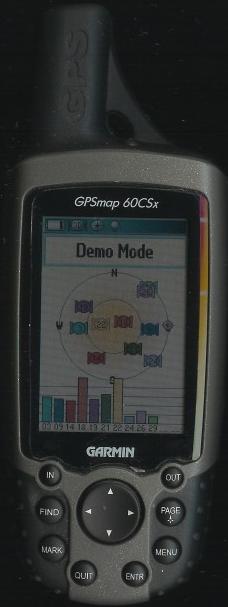
Here is the GPS map 60CSx in demo mode, this is roughly the right size.
You can have the satellite page in color or black and white.
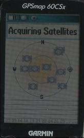
Acquiring satellites for me up in Canada takes about 30sec to get going
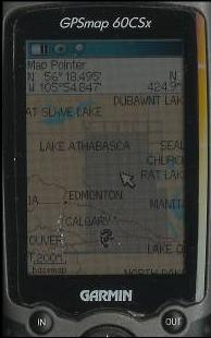
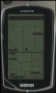
Map page at 200m, you can see all of Saskatchewan is loaded. This is in high detail.
When you zoom in you will get more resolution. This map is 251,366 sq mi
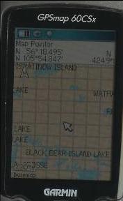
You can see each grid at 30miles. It has a high resolution map in each grid, as you zoom in you will get the land formation.
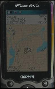
Now you can see the river and altitude.
3D map - you can get a visual lay of what is coming up and past that.
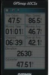
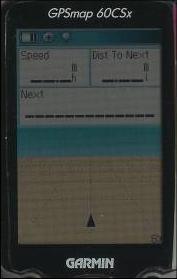
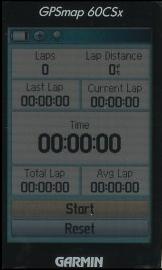
Trip page - this will give you all the info you need on a trip. You can change each cell to what you need.
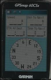
Compass - you can use this for most stuff, but you must calibrate it first. If you need to shoot a line you can.

Altitude and ambient pressure - this is good for hiking up the mountain or for storms that my move in.
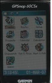
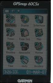
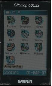
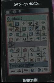
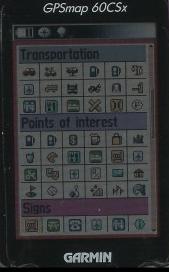
Main Menu - tracks, routes, highway, setup, proximity, calendar, calculator, stopwatch, sun & moon, hunt & fish, games
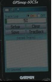
Track log - the options you get are good, you can track back, save & store to SD card.
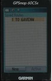
Routes - you be able to save your bug out runs.
Setup menu
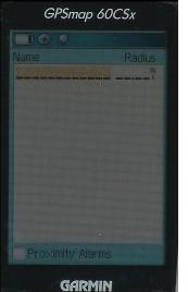
Proximity alarms - set this up to keep you out of the zombie zone ;)
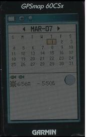
Calendar
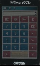
Calculator
Stop Watch
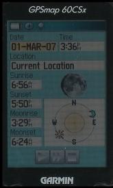
Moon phase - you might not want to move out on a full moon.
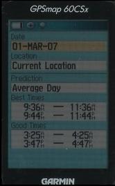
Hunt & fish - For me it was an average day
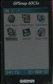
Game page - this is fun and you can have the kids play, this will get them a feel for the GPSMap60CSx
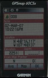
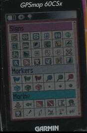
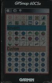
Waypoints - it's quick and you get a lot of Markers
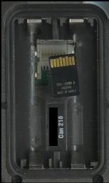
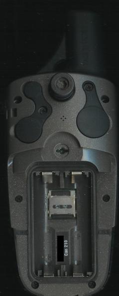
Heres with the back off. You can see the battery compartment and card slot. The top left cover is the external antenna port, below that is the data port and the top right cover is 12v power.
METROGUIDE NORTH AMERICA v8 DVD $109.95can
Version 8 features include:
TOPO will give you the moon phases or Celestial info so if you need to move at night and have no moon, you can. Or you can just find out when the moon will be full so you know when to stay home at night!! LOL.
Over all for $150.00 or less you have a good plan to bug out and have all your ways planned on your GPS.
Now you can't store all this data on one GPS, sorry, BUT you can take it with you!!
Now with the newer GPS models you can have it all depending on your budget.
The Garmin line... Etrex Venture CX, Legend CX, Vista CX, GPSmap60CSx... would be my picks for most uses as they have the ability to have a Micro SD card and they are simple to use. On a weekend you can play some games. They have games like Memory Race, Virtual Maze, Geko Smak, Nibbons, Gekoids, and Beast hunt which will start to get the Kids to learn and have fun too.
This Micro-SD will hold a lot of data for you. They are no bigger then (W) 5mm (L) 10mm But they are from 64mb to 4GB. This can give you an idea what you need for info. I use 197.4 megabytes for all of Saskatchewan, Canada which is 907 hi-resolution maps and still some left over on a 256MB Micro-SD card. So if I need to save waypoints, routes, or tracks to the card, I can.
If you have TOPO and Micro-SD you will be able to give maps to team members and share info and this will keep everyone on the same page, especially if you all need to be in one place. It will give Joe Blow information on how long it will take Sam the Man to get to point (A), if the Zombies don't get him first. :)
What will you need for a GPS? Some will say donÆt spend much! What is too much?
Legend CX $279.95 Can
Vista CX $299.95 Can
Etrex Venture CX $381.95 Can
60CX $399.95 Can
GPS map 60CSx $459.95 Can
If you donÆt need a altimeter, or electronic compass then you go with the Legend. All these are in color and for looking at the stats on power they do use less power than black & white screens. They also have the ability to pan the map up, down , L, and R, this is a must. I had one for a weekend that could not and I will not go there again. It was like having the 1st Gameboy, it did not do much good as a paper weight. If you want good reception you will need SiRF, this will give the ability to get GPS signal in the trees and coulees. It will acquire satellites quicker. In the initial setup it could take up to 5 minutes, but after that it's 1 minute or less. I have a Vista that takes 5 minutes to acquire satellites and if I get in heavy trees or coulees I will lose the signal. I was in downtown Calgary and did not lose signal with 60CSx, even with the high rises.
SgtSplatter
www.alpharubicon.com
All materials at this site not otherwise credited are Copyright ® 1996 - 2007 Trip Williams. All rights reserved. May be reproduced for personal use only. Use of any material contained herein is subject to stated terms or written permission.